Close-ups
Framed and on the wall

Frame and rooms are illustrations of how the print could look, drawn to its real size; it is sold unframed unless the description says otherwise.
Antiquity & ruins
Plan of Ancient Rome with the Fourteen Augustan Regions, d'Anville, 1818
€305€22925% off
$250 · £190
Original print, not a reproduction
Ships worldwide from the Netherlands, flat or rolled, insured and tracked. 14-day returns.
- Date
- 1818
- Sheet size
- 13.8 × 19.7 in (35 × 50 cm)
- Technique
- Copper Engraving
- Coloring
- Uncolored
- Condition
- Good. Light uneven toning, browner toward the edges. Marked handling soiling along the bottom, left and top edges. Foxing over much of the margin. Complete sheet, all four corners present. Several larger brown marks. A pale brown tide line runs along the lower margin.
- Collection
- Antiquity & ruins
- Era
- 1790 to 1849, Neoclassical and Romantic
- Stock no.
- BG-14399-15
What the condition grades mean
- Excellent
- Bright and clean, with no faults worth mentioning.
- Very good
- Only light signs of age, such as faint toning.
- Good
- Normal signs of age for a sheet of this period: toning, some foxing, small marks or neat old repairs.
- Fair
- Clear faults such as staining, tears or repairs, priced to match.
Every fault we see is written in the condition note, and the whole sheet is shown uncropped in the photos.
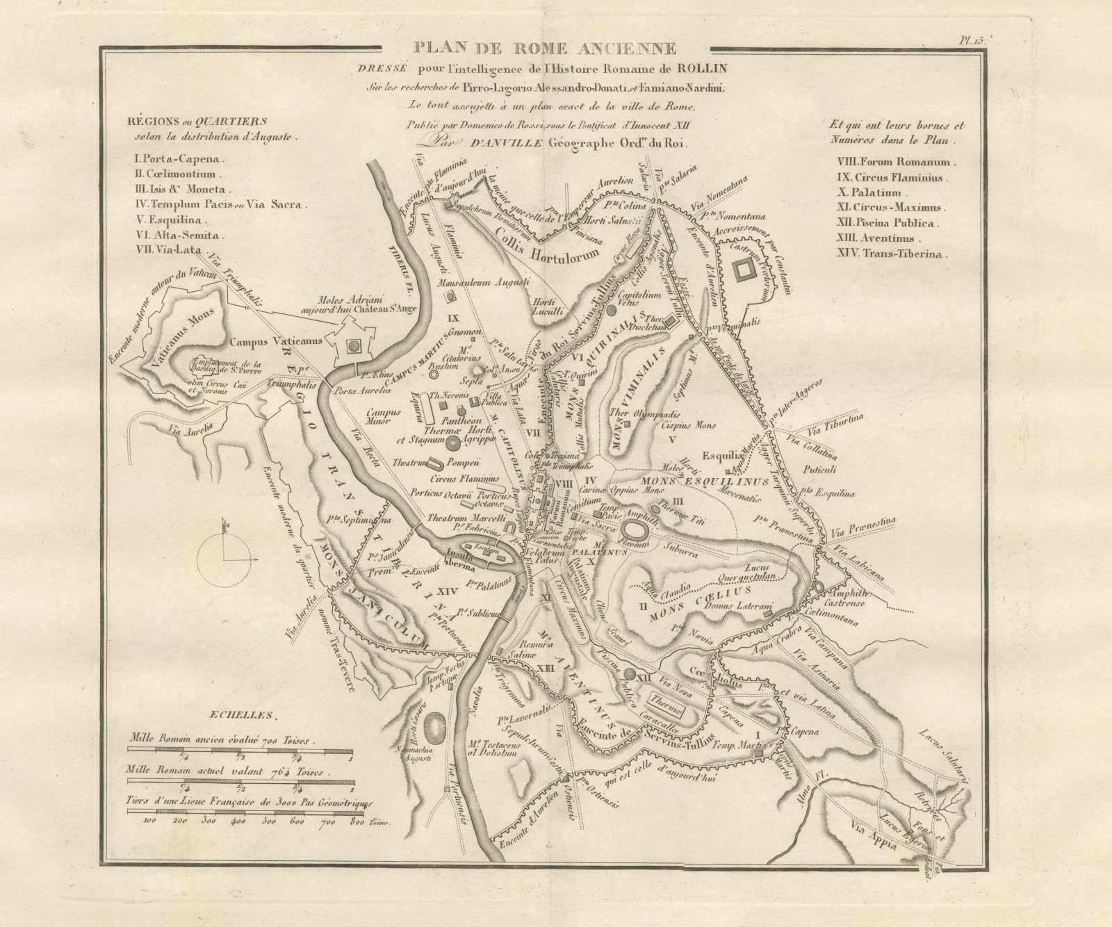
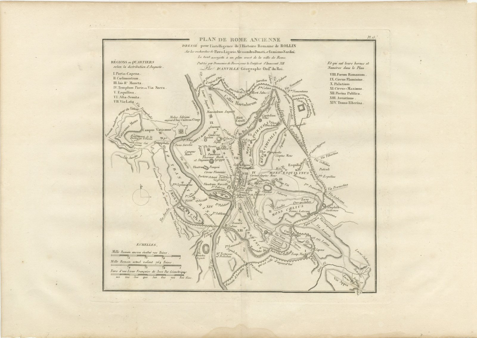
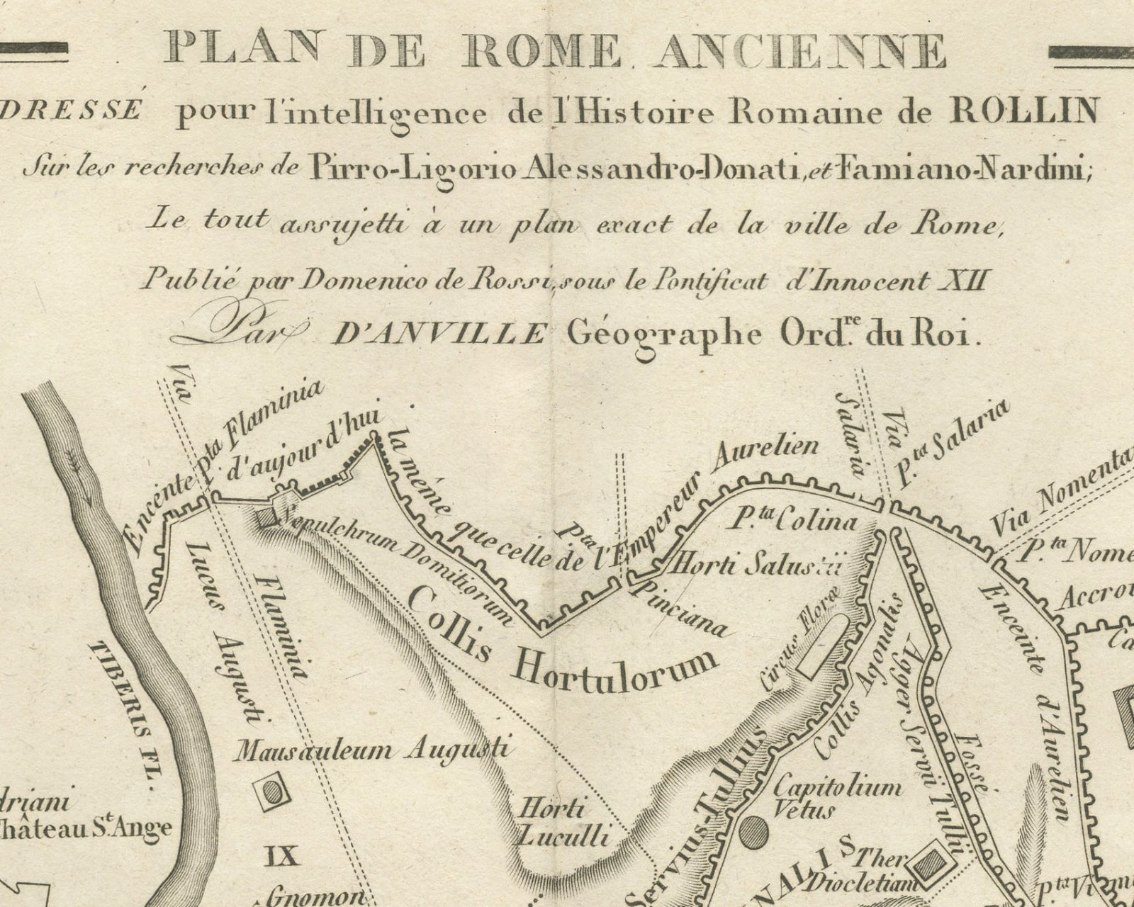
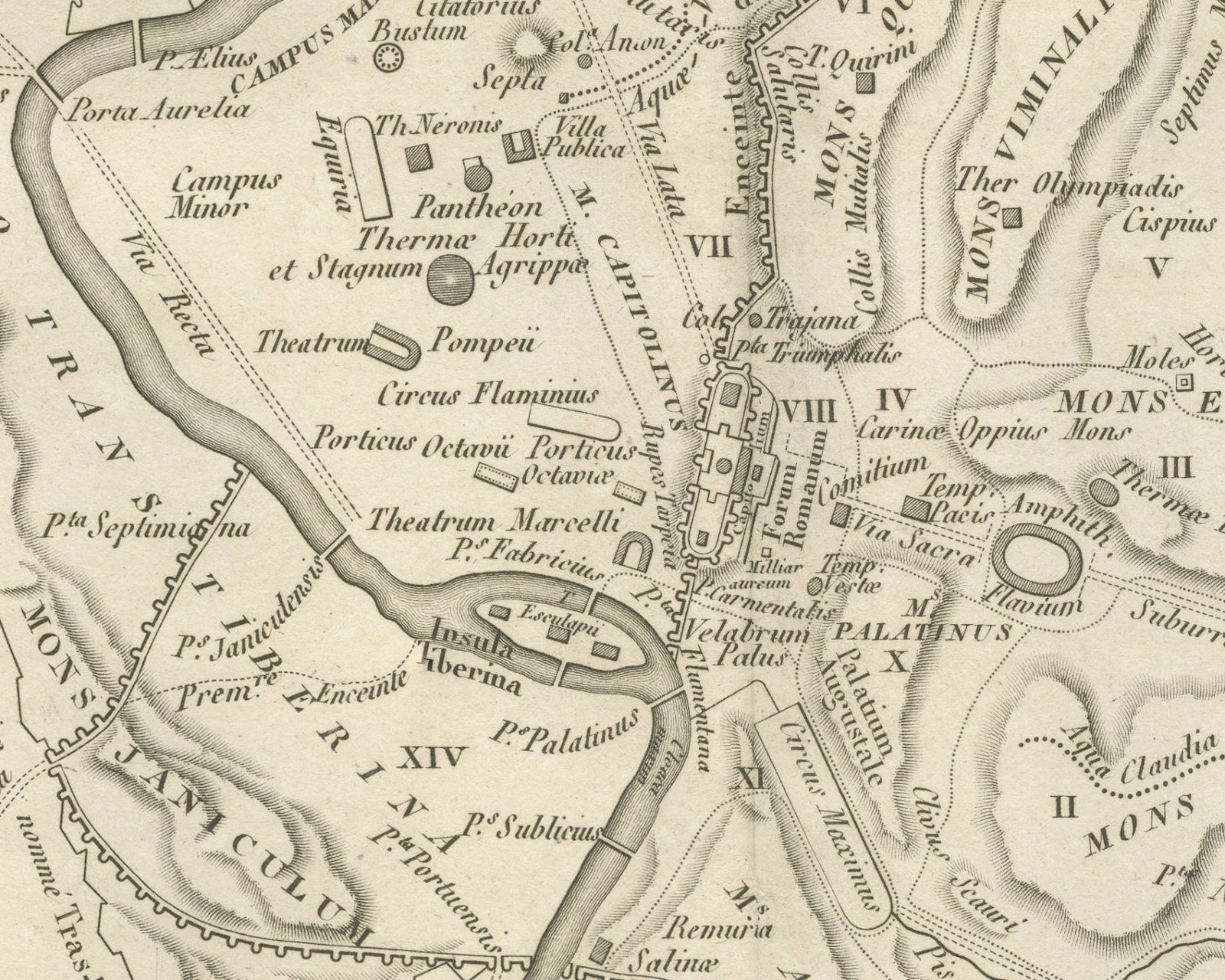
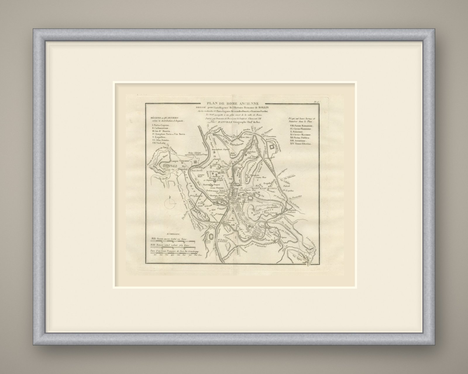
An original copper engraved town plan, uncolored, of ancient Rome. The Tiber crosses the plan from north to south, with the Vatican and Janiculum on the west bank and the Insula Tiberina in the river. The hills are lettered, among them the Capitolinus, Palatinus, Aventinus, Coelius, Esquilinus, Viminalis and Quirinalis. Within the walls the Campus Martius, the Pantheon, the theater of Pompey, the Circus Flaminius, the Forum Romanum, the Circus Maximus and the Flavian amphitheater are marked, together with the baths of Titus, Diocletian and Caracalla. The circuit of Servius Tullius and the later wall of Aurelian are both drawn and named, with their gates, and the Via Appia leaves the city at the lower right.
The heading reads *Plan de Rome ancienne dressé pour l'intelligence de l'Histoire Romaine de Rollin, sur les recherches de Pirro-Ligorio Alessandro-Donati, et Famiano-Nardini; le tout assujetti à un plan exact de la ville de Rome, publié par Domenico de Rossi, sous le Pontificat d'Innocent XII, par d'Anville, Géographe Ord.re du Roi.* Two key panels list the fourteen regions, Régions ou quartiers selon la distribution d'Auguste, I to XIV, each numbered on the plan. The plate is numbered Pl. 15. Under Echelles are three scale bars for the ancient Roman mile of 700 Toises, the modern Roman mile of 764 Toises and a third of a French league.
The plate comes from the Atlas de Géographie Ancienne, published in Paris in 1818 by Ledoux et Tenré and printed by Didot le jeune to accompany the works of Charles Rollin (1661 to 1741), the French historian, author of the Histoire ancienne and the Histoire romaine. Its maps are engraved after the originals of Jean-Baptiste Bourguignon d'Anville (1697 to 1782). In the foreword, signed by Ambroise Tardieu, géographe-graveur, Tardieu writes that the maps were copied with religious fidelity and that, charged with reviewing the proofs, he corrected only negligences and faults of execution. The plan serves Rollin's Roman history, showing the city as divided into fourteen regions under Augustus.
This is an original antique map, not a modern reproduction. This item is sold unframed.
Explore